Devon · PL21
Drone surveys in Ivybridge, flown by the surveyor who writes them
About fifty minutes from Exeter. A late twentieth century town on the southern moor edge, where mechanically fixed ridge and verge details matter.
A modern town in an exposed spot
Ivybridge is about fifty minutes from Exeter on the A38. It has a small historic core around the old bridge and mill, but it is overwhelmingly a late twentieth century commuter town: large estates of the 1970s through the 1990s, plus continuing new development.
That makes it unusual on this list. Most of the towns here generate survey work because their buildings are old. Ivybridge generates it because its buildings are young enough that the original specification is still the thing under test, and old enough that the first generation of coverings and details is now reaching the end of its service life.
Where the moor meets the estates
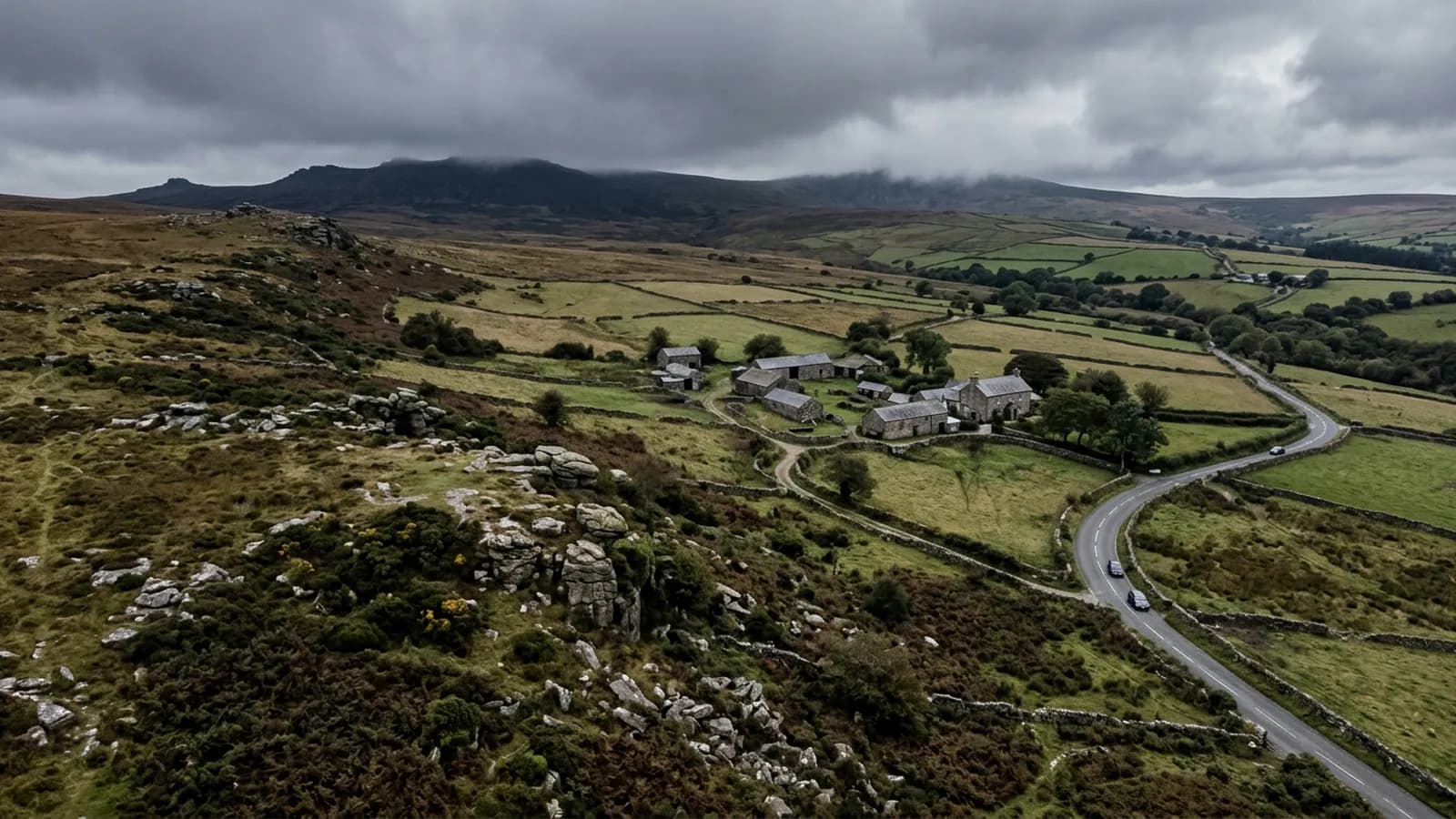
The town sits on the Erme at the southern edge of Dartmoor, where the moor drops steeply to the South Hams, so the northern streets sit noticeably higher than the southern ones. The moor edge position means high rainfall and strong gusting winds funnelled down the Erme valley.
Put those two facts together and you get the defining survey issue here: mechanically fixed ridge and verge details matter more in this town than in sheltered ones. A dry ridge system that is correctly fixed will sit out a gale. A mortar bedded ridge on an exposed northern street in Ivybridge is on a shorter clock than the same detail would be in Ottery St Mary.
Concrete interlocking tile dominates the estates, with natural slate on the older stock, fibre cement slate in places, and flat roofs on garages and extensions. Fibre cement is worth flagging: it weathers to look like natural slate from a distance and behaves nothing like it, so identifying which is which is part of the job and needs a close frame.
Estate housing surveyed at scale
An estate built over two or three years to one specification is the ideal candidate for aerial survey, and for the same reason as the railway terraces at Newton Abbot: what is true of one house is usually true of its neighbours.
For a landlord, a management company or a group of owners, flying several properties in one visit gives a comparative picture that a single inspection cannot. It shows whether a fault is a one off or a pattern, and it puts a number on how many roofs are in which condition.
Flat roofs on garages and extensions are the standing weak point in this stock. They were often the cheapest element of the original build, they are invisible from inside the house, and they are the first thing to fail.
Wind down the valley
The Erme valley funnels wind, and gusting is the characteristic rather than steady strength. For flying that means margin: an aircraft holding position beside a roof in gusty air is working, and the imagery shows it if the conditions are pushed too far.
The viaduct and the Two Moors Way mark the northern edge of the town, and beyond them is open moor. As at Okehampton, the local forecast is the one that counts and it can differ sharply from Exeter forty five minutes away.
Behind the survey
What Ivybridge clients are actually buying
Registered with the CAA
A registered operator with both an Operator ID and a Flyer ID. The Operator ID is the one that has to be displayed on the aircraft, and it is the number a client or an insurer asks for.
A2 Certificate of Competency
The A2 CofC is the theory and self-practical qualification that sits above the basic Flyer ID test. There is no GVC, which is stated here rather than left out, because it changes how some sites have to be planned.
Insured with Coverdrone
Commercial cover through Coverdrone, one of the specialist drone insurers. A copy of the certificate goes out on request before a booking, not after it.
DJI Mavic 4 Pro
The main survey aircraft. A 100 megapixel Hasselblad camera and 6K video, which is what lets a photograph of a ridge from twenty metres away still show an open mortar joint.
DJI Mavic 2 Enterprise Advanced
The thermal aircraft. A 640 by 512 radiometric thermal camera alongside the visual one, so a heat pattern can be read against the picture of the same elevation.
Construction background
The surveying came after years of contracting, so the report is written by somebody who has stood on the scaffold as well as flown over it, and who knows which faults matter and which are cosmetic.
Written report within 48 hours
A process commitment, not a sales promise. The flight is the short part of the job; the report is where the time goes, and it lands within two days of the visit.
No scaffolding, no ladders
Nothing leans on the building and nobody goes up it. That removes the access cost, the permit paperwork and the working-at-height risk from the survey itself.
Nearby
Also covered around Ivybridge
- PlymouthAbout an hour down the A38 and the biggest urban job on the list: limestone ridges, post-war flat roofs, and salt wind coming straight off the Sound.
- TotnesAbout forty five minutes from Exeter. A steep medieval hill town on the Dart, packed with hidden valleys and party wall abutments.
- TavistockAbout an hour from Exeter. A Victorian planned town in green Hurdwick stone, very wet, with tall stone stacks that take real wind loading.
See the credentials
Talk to a surveyor in Ivybridge
Send the address and what is worrying you. Sam Hembury will come back with a fixed price and the next slot that suits the weather.