Devon · EX1-EX6
Drone surveys in Exeter, flown by the surveyor who writes them
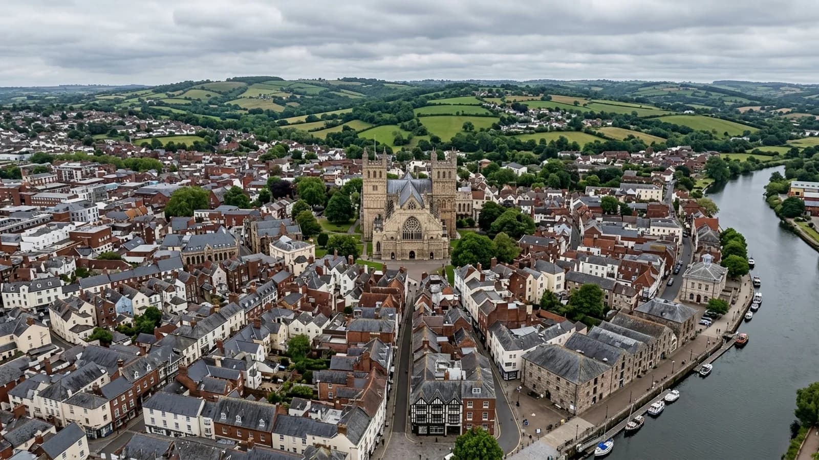
The base town, ten minutes away. The constraint in Exeter is other people rather than distance: dense roofscapes, student blocks, city airspace.
This is where the aircraft live
Exeter is the base, which changes the arithmetic on a small job more than people expect. A single chimney stack in Heavitree or St Thomas is worth flying on its own, where the same job an hour and a half away would sensibly wait to be paired with something else. If the question is small and you are in the city, ask.
It also means the desk check on an Exeter address is quick, because the ground is familiar. What is behind a terrace on a particular street, whether there is anywhere sensible to launch from, and which side of a building the wind comes round are all things worked out on foot rather than from an aerial photograph.
The city constraint is people, not access
In most of Devon the hard part of a survey is getting to the building. In central Exeter the building is easy and the surrounding population is the problem. Georgian and Victorian terraces through the older quarters sit shoulder to shoulder with pavements, gardens and parking on every side, so almost every take off point has somebody near it who has nothing to do with the job.
That is the constraint the permissions actually bite on. Planning a flight in a packed street is a matter of where the aircraft can be launched, how high it climbs before it moves laterally, and which neighbouring garden it is not going to be over. Some addresses need the survey flown early on a Sunday. A few cannot be flown at all within the rules held here, and that gets said before a date is agreed rather than on the doorstep.
Airspace is the other city question. Exeter is not a free-for-all overhead and the check happens at quote stage rather than on the morning. Where a restriction affects what can be done, it changes the plan or it changes the answer.
The roofs the city actually has
Four coverings dominate and each fails differently. Natural slate on the older central stock, where the nails go long before the slate does. Clay double roman on the interwar and Victorian fringes, which sheds a tile when the batten behind it softens. Concrete interlocking tile on the post-war ring, heavy and durable but unforgiving at ridge and verge when the mortar bedding lets go. And felt and single ply flat roofs on extensions, garages, commercial blocks and the purpose built student accommodation near the university, which are the ones that quietly hold water until somebody looks down at them.
That last category is the one a drone changes most. A flat roof on a three storey block is invisible from every window and every pavement, and the first anybody knows about a pond around a blocked outlet is a stain on a ceiling two floors down.
The city's rainfall is above the England average and the valley holds damp air, so north facing slopes here dry slowly and organic growth is persistent. Moss in a valley gutter is not a cosmetic finding in Exeter. It is a blockage waiting for a wet fortnight.
Landmarks, and what they mean for a flight
The Cathedral, the Quayside, the University and Marsh Barton are the four bits of Exeter most people picture, and between them they cover the range of survey work the city produces. Historic fabric with complex lead and stone detail. Waterside buildings taking damp off the Exe. Institutional accommodation with flat roofs and plant. And a trading estate full of large span roofs where the rooflights and the parapet gutters are the whole job.
The ground itself matters too. The city sits on a low ridge above the tidal head of the Exe, falling away east towards the Clyst valley and rising west towards Haldon, so two properties a mile apart can be in quite different wind. A survey on the western slopes catches more weather than the same building down by the water.
Behind the survey
What Exeter clients are actually buying
Registered with the CAA
A registered operator with both an Operator ID and a Flyer ID. The Operator ID is the one that has to be displayed on the aircraft, and it is the number a client or an insurer asks for.
A2 Certificate of Competency
The A2 CofC is the theory and self-practical qualification that sits above the basic Flyer ID test. There is no GVC, which is stated here rather than left out, because it changes how some sites have to be planned.
Insured with Coverdrone
Commercial cover through Coverdrone, one of the specialist drone insurers. A copy of the certificate goes out on request before a booking, not after it.
DJI Mavic 4 Pro
The main survey aircraft. A 100 megapixel Hasselblad camera and 6K video, which is what lets a photograph of a ridge from twenty metres away still show an open mortar joint.
DJI Mavic 2 Enterprise Advanced
The thermal aircraft. A 640 by 512 radiometric thermal camera alongside the visual one, so a heat pattern can be read against the picture of the same elevation.
Construction background
The surveying came after years of contracting, so the report is written by somebody who has stood on the scaffold as well as flown over it, and who knows which faults matter and which are cosmetic.
Written report within 48 hours
A process commitment, not a sales promise. The flight is the short part of the job; the report is where the time goes, and it lands within two days of the visit.
No scaffolding, no ladders
Nothing leans on the building and nobody goes up it. That removes the access cost, the permit paperwork and the working-at-height risk from the survey itself.
Nearby
Also covered around Exeter
- TopshamTen minutes from Exeter. A dense listed core on the Exe estuary, where salt air and hard driven rain do the damage rather than neglect.
- ExmouthTwenty minutes from Exeter and the most exposed town on the list: two miles of open front, unbroken salt wind, and uplift at ridge and verge.
- CreditonFifteen minutes from Exeter. Cob and thatch in the lanes, Devon slate and stone tile in the town, and a valley that is hard on thatch ridges.
- CullomptonTwenty five minutes up the M5. A Culm valley town of medieval fabric, thatch and modern estates, on ground that holds damp and frost.
- Newton AbbotAbout half an hour from Exeter. A flat floodplain town of railway-era terraces and trading estate roofs, where mist off the Teign keeps shaded slate green.
See the credentials
Talk to a surveyor in Exeter
Send the address and what is worrying you. Sam Hembury will come back with a fixed price and the next slot that suits the weather.