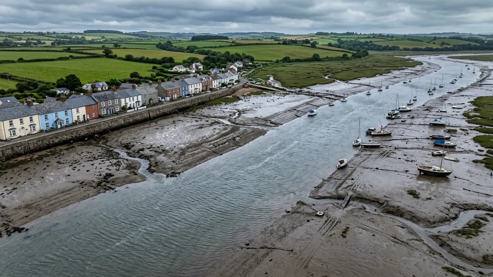
Devon · EX9
Drone surveys in Budleigh Salterton, flown by the surveyor who writes them
Around twenty five minutes from Exeter. Substantial detached houses in generous plots, long held and lightly altered, with thatch on the outskirts.
A town of long ownership
Budleigh is about twenty five minutes from Exeter. The stock is Victorian and Edwardian villas plus a good deal of substantial detached housing in generous plots, with bungalows on the higher ground, and a mature population means many properties are long held and lightly altered.
That last point matters more than it sounds for a survey. A house that has been in one family for forty years often has original coverings, original rainwater goods and original detailing, maintained but not replaced. The faults are therefore age related and gradual rather than the result of a bad recent job, and they are spread evenly across the whole roof rather than concentrated where someone worked last.
It also means the person commissioning the survey often knows the building intimately from the inside and has never seen the top of it. That is a good starting position: the questions are specific and the answers are worth something.
Generous plots make for straightforward flying
Detached housing in large gardens is close to the easiest survey case there is. There is somewhere on your own land to take off from, the building is not shoulder to shoulder with anyone else's, and the aircraft can get round all four elevations without ever being over a neighbour.
That is a genuine practical difference from a terraced town, and it shows in what can be delivered. Every slope, every stack, every gutter and every abutment, at whatever distance gives the clearest frame, without any of the compromises a tight site imposes.
The bungalows on the higher ground are simpler again, though they carry the same blind spot as bungalows everywhere: the owner sees the front slope from the drive and has never seen the back one at all.
Thatch, and why it is a different survey
There is thatch on the outskirts, and thatch from the air is one of the more useful things a drone does. Ridge condition, the depth of the coat, wear patterns around chimneys and dormers, netting condition and the state of the fixings at the eaves all read clearly from above and are close to impossible to assess properly from the ground.
A thatch inspection does not replace a master thatcher's opinion and the report says so. What it does is tell an owner whether they need one now or in three years, and give the thatcher something to quote from before they arrive.
Alongside the thatch there is natural slate, clay plain tile and concrete tile on the post-war stock, so a single street can carry three or four coverings with entirely different lifespans and failure modes.
The sea and the Otter
The town is open to the south and south west with no shelter from the sea, though the valley sides take some of the edge off. Salt spray reaches the front ranks of housing in winter storms, so properties on the seaward side get the corrosion questions asked of them and those a few streets back mostly do not.
East of the town the Otter estuary and its reed beds form a nature reserve, and the wooded slopes rise sharply behind the high street. Both are considerations for a flight plan rather than for a roof: wildlife areas are given a wide berth, and the wooded slopes affect how the wind arrives at properties tucked under them.
Behind the survey
What Budleigh Salterton clients are actually buying
Registered with the CAA
A registered operator with both an Operator ID and a Flyer ID. The Operator ID is the one that has to be displayed on the aircraft, and it is the number a client or an insurer asks for.
A2 Certificate of Competency
The A2 CofC is the theory and self-practical qualification that sits above the basic Flyer ID test. There is no GVC, which is stated here rather than left out, because it changes how some sites have to be planned.
Insured with Coverdrone
Commercial cover through Coverdrone, one of the specialist drone insurers. A copy of the certificate goes out on request before a booking, not after it.
DJI Mavic 4 Pro
The main survey aircraft. A 100 megapixel Hasselblad camera and 6K video, which is what lets a photograph of a ridge from twenty metres away still show an open mortar joint.
DJI Mavic 2 Enterprise Advanced
The thermal aircraft. A 640 by 512 radiometric thermal camera alongside the visual one, so a heat pattern can be read against the picture of the same elevation.
Construction background
The surveying came after years of contracting, so the report is written by somebody who has stood on the scaffold as well as flown over it, and who knows which faults matter and which are cosmetic.
Written report within 48 hours
A process commitment, not a sales promise. The flight is the short part of the job; the report is where the time goes, and it lands within two days of the visit.
No scaffolding, no ladders
Nothing leans on the building and nobody goes up it. That removes the access cost, the permit paperwork and the working-at-height risk from the survey itself.
Nearby
Also covered around Budleigh Salterton
- ExmouthTwenty minutes from Exeter and the most exposed town on the list: two miles of open front, unbroken salt wind, and uplift at ridge and verge.
- SidmouthAbout forty minutes from Exeter. A Regency town in a steep valley, where hills either side funnel wind and make the air round chimneys turbulent.
- Ottery St MaryAbout half an hour from Exeter. An inland valley town where mist and damp let moss establish fast on shaded slopes, with cob and thatch in the lanes.
- TopshamTen minutes from Exeter. A dense listed core on the Exe estuary, where salt air and hard driven rain do the damage rather than neglect.
See the credentials
Talk to a surveyor in Budleigh Salterton
Send the address and what is worrying you. Sam Hembury will come back with a fixed price and the next slot that suits the weather.