Skip to content
Drone SurveyorsExeter · Devon and the South West

The work

Three kinds of job, and what each one involves

A surveyor who lists a dozen services is describing a market rather than a working week. These are the three things the aircraft on this site are used for, with what is included and what is not on each one.
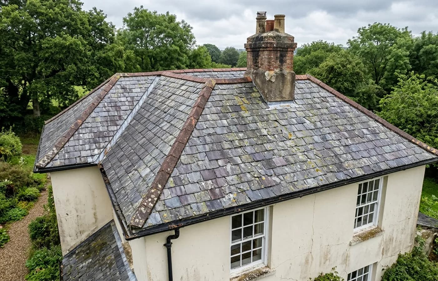
Aerial view of a Devon house roof from twenty metres at a three quarter angle, showing ridge tiles, a brick chimney with weathered flaunching, a lead lined valley and cracked slates with lichen

Roof and building inspection

The main job: every slope, elevation, stack and gutter photographed close enough to make a decision on, without anything touching the building.

  • Every roof slope and every elevation covered systematically, not just the side that prompted the call
  • Close detail frames of ridge, hip, valley, verge, abutment, flashing and stack
  • Rainwater goods looked into rather than at: gutters, hoppers, outlets and parapet gutters
  • Flat roof coverings photographed straight down, including outlets and upstands
Roof and building
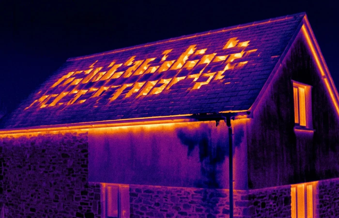
Radiometric thermal image of a house gable and roof slope in the ironbow palette, showing warm patches where loft insulation is missing between joists and a cool damp area below a blocked gutter

Thermal inspection

The radiometric camera on the Mavic 2 Enterprise Advanced, used where the question is heat, damp or trapped moisture rather than what a covering looks like.

  • Radiometric thermal imagery of the elevations or roof areas in question
  • The matching visual frame for every thermal frame, so the pattern can be read against the building
  • A written interpretation of each pattern, including the ones that turn out to be nothing
  • The conditions on the day recorded, because they determine what the imagery is worth
Thermal
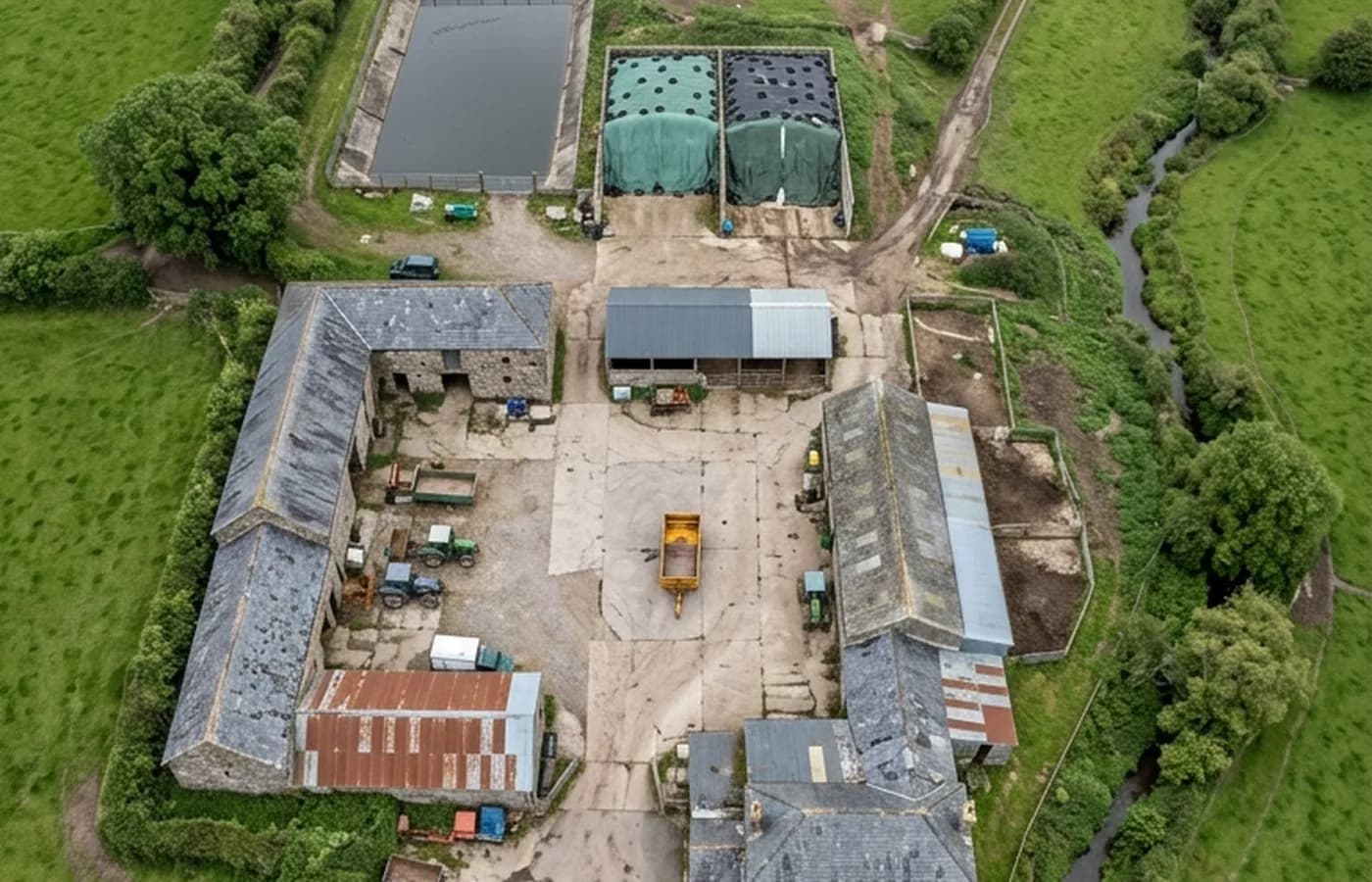
Vertical aerial view straight down over a Devon farmyard from eighty metres, showing stone barns with corrugated and slate roofs around a concrete yard, silage clamps and tracks running out between hedged fields

Mapping, records and search

Everything flown over an area rather than a building: mapping runs, dated site records, aerial photography, and searching open ground when something is missing.

  • A planned run at consistent height and overlap over the area agreed
  • A dated set of frames that can be compared directly with a later flight
  • Oblique frames as well as vertical ones, because a bank or a wall reads better from an angle
  • Aerial photography for marketing or records where that is what is wanted
Mapping and records

See the credentials

Talk to a surveyor with Drone Surveyors

Tell us the address and what you need looking at. Sam Hembury will come back with a fixed price and the next available slot.

Call 07426 908037Talk to a surveyor